Wednesday 30 November 2022

Ternopol Wald, south and around Ternopol

 Yesterday, I posted this area of Ternopol Wald, without completing it:


In order to get past the cut line between two map sheets, I've done all six hexes including Chertkov north.  To start with, here's the first two hexes, with a rough map of the remaining area to be done:


Down at the bottom, we have some new things.  Between Koropets and Peredmistya is an empty type-8 hex with a different pattern than the "forested" colour I've been using.  I've struggled and struggled to find a good representation for this kind of hex.  I think I've finally found one.  Many of the earlier maps have to be adjusted, which I'll do as I move along.

This is an empty steppeland, not arable due to lack of water and poor soil ... something that came up with Shelby on the main blog.  The scattered hills suggest a dry highland, where the water table is so far beneath the surface as to be impractical.  Coincidentally, there's a good reason why this should happen.

The very curled course of the Dniester river is the result of the "Dniester Canyon," with much of it 500 ft. below the plateau above.  This is the river cutting down from the Podolian Upland and into the valley of Bukovina, where the large modern city of Chernivtsi is located.  I've been careful not to create any routes across the river between Nishniv at the top and the trade route on the east, which does not bridge the river in any case.

I know I haven't published the map in relation to those on the west and south.  This is done below.  For the moment, here's a rough map of the remaining four hexes to be done, or two sections:


Virtually all of this area is steppe.  This begs the question, if I'm using progressively darker green colours for less developed hexes, shouldn't these change to something more brown as we move into the steppe?  Hm.  I've considered it ... and done some experimentation also.  But the truth is, the discontinuity is instantly so confusing that it fails to provide the quick-look index of the existing colour scheme.  As such, it's better to remember these areas are open prairie rather than try to represent that.  The hex type colours, therefore, are not representative of "trees," though it'll look like that over much of the map.  Only the wilderness hexes, that are type-8 and not designated on the map, will reflect the natural vegetation.  I don't find this the least confusing.  It's certainly less confusing than any alternative I can think of.

Okay, here's all the region I've done today, including all three sections, or six 20-mile hexes, without background:


Remember, this is two map sheets overlapping, because these three sections straddled two sheets.  Sorry about the flotsam that could have been deleted.  I missed it until after this composite image was put together, and I didn't want to do it again.

I don't know why, but the village dot for Peredmistya, west of Chertkov, has disappeared; that needs fixing.  Additionally, the type-4 village Nastasiv, should have that road going to the larger nearby Ternopol, not Zaboika.  Small bits and pieces.

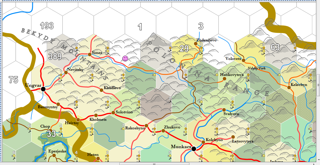
This is the last of the Ruthenia sheet for awhile.  Here's a rendering of the whole sheet, just as I did for Nyatria last week:


Compare this with what this map looked like when I started this post on November 9th, three weeks ago:


See?  Stuff gets done.

Tuesday 29 November 2022

Towards the Corner

This is my second post today; don't read the first.

The next section that needs to be done for the map is shown below.  It extends over the next sheet, K.26e - Czernowitz:


The reader can see the background has shifted, so that all the labels are turned 60-degrees clockwise.  The time has come to explain why.  Before reading this, you may want to familiarise yourself with this very old post.

Have a look at these two 20-mile map sheets:


The map on the left, "Carpathians," has served as the background for the mapping of Hungary, Slovakia and Ukraine that we've done so far, while the map on the right is what'll be used going forward.  The Danube Mouth has been turned 60 degrees clockwise, as compensation for the Earth's curvature.  While strange, and often annoying (as you'll see), this turn enables me to effect a huge, unbroken flat map of the game world without having to stretch the polar center flat, as in a Mercator projection:


This represents most parts of the world that I've mapped in 20-mile hexes.  I had a large part of China done, before (I believe) accidentally deleting the files; some of Mongolia has been done, and a big part of Africa south of the line shown.  The reader can clearly see how the curve of the Mediterranean twists into the levelling of the Black Sea (assuming you know where these are without needing labels), or how India twists towards the right as it approaches the 90th meridian east, where the map turns again into Burma.

This would bother some people.  You may note on the comments connected to the link above, to the old post, that a number of people have firmly suggested putting the map on an actual globe.  Of course, there are two big problems with that.  First, it's very difficult to fit the globe into a scanner, so it can be put online ... and two, none of the pundits suggesting the globe idea have done anything.  Nix, nada, nothing.  This may help explain my contempt for pundits in general.  Full of ideas, shit for making something.

The map turn is a bitch, no question about it.  Usually, a rectangular sheet map, like "Carpathians" above, always overlaps adjacent sheets by just two hexes, such as I demonstrated here (see bottom of post).  The "corner map" overlaps considerably more, to ensure I have complete coverage, as shown:


When I make a corner map, this is the template I use.  The orange line represents the parallel, say the 30th E, that dictates the turn taken.  The blue line follows a row of hexes, showing that as we move from west to east, we simply turn the roads in a new direction.  In a few weeks, you'll see this done and be amazed at how perfectly simple it is ... and how the result is undetectable at a close-up scale, even at 20-miles per hex.  The "overlap" shows how much of the Carpathians map folds over the Danube Mouth map ... thus we can see the turn of the Carpathian mountains, represented by brown hexes, on both maps, even though the Danube has them turned 60 degrees.  Finally, the bottom left of the map ends up extending deep into the ring of maps below.  Carpathians and Danube mouth are the "D-Ring."  The "E-Ring" appears on the Carpathian maps only as the bottom two hexes ... but the corner hex sucks up a great deal more of the E-Ring.  That's why we can see part of Thrace showing up on the Danube Mouth map.

This repetition of maps, so that both sheets are duplicates of the other, is an enormous headache.  They have to be nearly perfect as well, or else I could not put them together to create a single, great map, such as the big map of the world shown above.  Unfortunately, Publisher as a program ffing won't turn a picture 60 degrees without distorting it a tiny, tiny, tiny bit.  Just enough to grind my teeth.

So, as we move towards the 30th parallel (we're at the 26th), the distortions between the map being made and Google Earth increase, ever so slightly, and never in a way that can't be tolerated.  Then the overlap has to be compensated for.  And then, as we move away from the 30th, the map becomes less distorted and from thence forward, there's only a hassle when the 30th is actually approached and crossed.  I've already done enough work that the main center of the whole 6-mile map I've done is past that overlap.  Wasn't much fun, I can tell you.

Tarnopol Wald and Lwow, around Berezhany

Starting with this:


"Wald" is a High German word meaning forest, but it also carries the denotation of power and strength, and most importantly here, possession.  Like Halicz Duchy, Tarnopol is a direct possession of the Polish Crown.  Part of it is forested, but much of the land has been denuded of trees since the 17th century and the Tarnopol region has become something of a desolate steppe.  But, we needn't worry about that for our game.  There is steppe in east Tarnopol, but not on this side of the hills running north-south on the east side of Berezhany.

Bobrka was misplaced too far south, but I nearly got Berezhany right:


This completes Lwow for the time being ... and nearly completes the sheet map.  The divide between the Dnister basin and the Bug, to the north, splits down the Podolian Plateau.  Regions like this are fairly homogenous, split between open farmland on the left and forested farmland on the right.  The discontinuity helps make sense of the boundary: it's there because it defines the point where the soils are become fertile, which is pushed into the province of Tarnopol.  This, too, is an explanation for why infrastructure isn't distributed outside a region's boundaries ... because these kind of sharp divides occur in the real world.  The generator needs a way to reflect that.

Remember that the population of Ternopol province determines it's infrastructure.  That population is distinct from the number that defines Lwow.  This separation needs to be respected in mapmaking.

This is all the map I'll add today ... however, I'm going to write another post about my map in general.  That'll go up as soon as I can write it.

Monday 28 November 2022

Halicz Duchy and Lwow, South and Around Halicz


Going to do the above area and the one above that, surrounding Halicz (pronounced Halich).  I'm on the edge on the Ruthenia sheet map's east side, so we'll be done with this sheet in a couple days.  Funny how fast they go.  In fact, a 6-mile map is only about 200 miles wide, edge to edge, so it's not surprising that doing 20 by 40 mile sections, we'll be flying across them when going straight east.  Progress is always slower north south, since it's done in 20 mile reaches instead of 40.  

In modern times, the hex on the left, 14 infrastructure, has a big city in it, Ivano-Frankivsk, but as it was founded in the 18th-19th centuries, it doesn't exist in my game world.  As a result, the area is somewhat sparse, compared with the heavy areas that were posted yesterday:

The river is the Dniester, the easterly course that we started yesterday.  As can be seen on the background, it's synched with the course of the Dneiper I mapped 15 years ago.  Whew.

Only the barest foothills remain, which makes the map look stark and less interesting.  Still, it's easier to map when I'm not proliferating hills and mountains into every corner.

Here's the next section to the north, undone:


Again, we can see the river to be filled in.  Just about everything on the northern edge of the work above had to be adjusted and altered, once I began comparing this with Google Earth.  Halicz moves west, the tributaries from the south get adjusted and the roads move.  The key is to see all work in a temporal fashion; what was done, even 45 minutes before, gets trashed the moment we have more information.

In any case, this completes the main parts of Halicz Duchy.  There are edges to complete, but the small area is effectively laid out.


Halicz itself is interesting.  I'll have to make a post this week explaining exactly how the settlement ended up in a 6-mile hex ... it's a deliberate quirk of the system that produces this result every once in awhile.  What's interesting is how Halicz as an entity has collapsed, aided by a combination of history, it's shrunken 20th century population and my map generation.

The town was once the dynastic seat of the powerful Volhynian realm in the 12th century, which challenged Kiyev, Lithuania and Poland for supremacy over the region.  Unfortunately, the town was devastated by the Mongols in 1241 and it never recovered.  My game setting takes place four centuries later, by which time Halicz is an ignored backwater under the control of the Kingdom of Poland; in the 20th century, this decline had continued so long that archeology became the region's chief claim to fame, as ancient buildings were uncovered in digs.  According to my population calculation that's applied to every settlement, my Halicz has a population of only 938, so that it's ceased being a town.

By the results that put it in a type-6 hex, the settlement has barely any services.  I like to imagine the place as essentially a ruin, with residents scraping out farms while transshipping local produce.  Even the roads linking Halicz to the outside are less than pristine.  Still, there are five routes out of the place, so it's not completely ineffectual ... but coming through the "village" would reveal it to be a wretched, broken-down dump, with collapsed buildings, dispersed hovels and an absence of local ambition.

Probably the duke of the province can hardly be found there.

Not much else to say, except that I love how the rivers slowly gather and become bigger, from tiny tributaries that wend their way into valleys.  Connecting the Dneister sources together was gratifying; there's still a section left to put together, but the main lower course has already been mapped.  Somewhere farther east, we'll encounter the Bug ... and before swinging back around to do southern Bulgaria, we'll touch on the outflow of the Dneiper, where the fighting's going on.  Should reach a lot of this in December, if I keep up this pace.

Sunday 27 November 2022

Lwow County, south of Lwow

It's Sunday, so I'll take the time this morning to put together these four 20-mile hexes, or two sections:


The numbers say it's going to be chock full of people, and they're not wrong.  There were a few issues that came up, however.  I made the original background map to this in, I think, 2006.  I mislocated the three settlements on the map, all of which are still here but with their arrangement changed.  Further, I utterly screwed up the course of the upper Dniester River, so changes have been made to correct that also.  The grey river that flows into Horodek on the map above no longer does; now it goes east to where it'll connect with the river out of Stryj.  Here, I'll show you:


There it is, without the background.  The correction still isn't accurate.  The Dniester rises west of Sombor.  But, meh ... it'll do for this map.  Nice how the hills thin out as we progress away from the Carpathians, without evaporating completely.  As I've said in the past, fantasy maps tend to have sharp boundaries on all their topographic features.  That's not how topography works, however.  Features blend one into the next, and it's the blending that gives each part of the world its distinctive flavour.  Such as the above.  Heavily populated, but still with each village either being surrounded by its local valley or part of a gathering of places on a wider plane.

Wasn't too hard to work around the large "Podolian Uplands" label.  Can't decide if it's better to put labels of this size in first, or wait until the rest of the map is done.  Experimented a little last night with political region labels; I'm not happy with how it looks yet.  I think I may have to create the letters individually as their own images.

The blue numbers on the map are merely notes to define how large the river line should be, since the numbers on the background are now defunct.

Saturday 26 November 2022

Halicz & Lwow, south of Stryj

Back into the mountains again:


Halicz, on the east, is a historical principality founded by Vikings, the Rus, along with Kiyev and Moskva.  Since it's decline in the 14th century it's faded considerably, depopulated and since annexed by the Polish crown.  The region itself is personally under the authority of the Polish Monarchy, since Queen Jadwiga annexed it in 1387.

I never know exactly how these areas are going to pan out until I actually create them.  I could see from the numbers there wouldn't be much, but as it turned out, not a single village was generated:


Somewhat desolate for Europe, but we'll be getting into the heavily populated part of western Ukraine next.  I did some adjustment to allow the connection between Ruthenia on the south and the cart path across the Gorgany Mountains.  I like these obscure routes.  This one is surrounded by mining hexes; usually, I judge any hex with three mountains in it as a mining hex, which is why that one type-5 in the middle is a farm hex.

The giant N and M occur because I was fiddling last night with squeezing in a label for the Carpathian mountains.  To my surprise, I made it fit:


I appreciate that I'm somewhat lax about putting in all the labels.  Often, it's because the labels just won't fit realistically inside the "mess" ... but sometimes it's just 'cause I'm lazy.

Speaking of which, I've been meaning to produce a map key for the roads and mountains, to explain there's a certain logic in how these things come around.  The roads of course are based on the roads and routes descriptions on the wiki ... but the hill and mountain systems haven't been defined until now.

The mountain size isn't a hard rule; if the hill seems peculiarly important, I'll use a mountain symbol for it, as I did for the odd hill in Tokaj.  I stick to the numbers given for the most part, however.  This makes an easy short hand to see how high the mountains are for a region ... sorry I haven't put this together until now.

Was going to say that in future, I'll be giving hammer/coin numbers for any cities I map with more than 5,000 residents, as proposed in this post on the main blog.  Over time, I'll start accumulating these numbers.

What I'd really like are some small symbols to put on the map itself, designating at least a half dozen of the more important facilities, so that these can be seen at a glance when looking over the map.  However, I've gone looking for such symbols, as they should look for a medieval map, and haven't had much luck.  If the readers would like to propose which facilities are the most important, and if anyone would like to draw and submit a symbol for use, please feel free.

Friday 25 November 2022

Galicia, around Lesko

As I said with the last post, this is as far north as we go for awhile:


The west side includes a spur of the Carpathians that reaches north; Lesko is in the extreme southeast of modern Poland, of which Galicia is a modern province.  The province is heavily populated, more than 440 thousand.  Krakow, about 140 miles WNW of Lesko, has a population of 75,000.  Thus the main of the population and infrastructure is on the fat plain in west Galicia.  This part is comparatively less developed.  Keep an eye on that 10 infrastructure.


Presenting this as a wider shot because I've also completed the two hexes to the east, around Sambor.  The 10-infrastructure hex I mentioned presented no village at all, not even a type-5 hex, so it's a collection of scattered, isolated hamlets and thorps in the hill country shown.  The east side of the section was all small type-4 villages, with the exception of Lesko.  Shows a definite, rustic agrarian setting.  Nonetheless, it presents an important route through the Carpathians between Galicia and Upper Hungary.

The north edge of the completed part above is showing a thinning of the hills, so we're getting on the other side of the Carpathians now.  This is even more evident with the completed section around Sambor, below:


The hills, called the "Low Beskids," are definitely thinning now. As we go east, geographically the area becomes the Podolian upland. This area proved disastrous for the Russians and Austrians in World War I, as the region became frozen over and the armies on both sides were bogged down fighting over the rolling terrain. The German tanks rolled easily and quickly through this country when they advanced into Russia in 1941.

We've turned the corner on the map, so it's all east from here.  I'll provide a longshot without the background to provide a feeling for the method I'll follow:


The 60-degree slope is three 20-mile hexes high.  The reader should note that when we walked up through Hungary, the mapping was a swath 120 miles wide, with three sections end-to-end.  Now I'm only going to cut a 60-mile wide swath through Ukraine.

The main reason is that I have a great deal more east-west to create than north-south.  From where we are, it's only 32 degrees latitude to the top of the world's map, where as the same number of degrees longitude east only gets us to north of the Aral Sea.  It's a long, long haul around the world compared with mapping to the north or south, so the emphasis is to stretch out the map.

Out of interest, here's how much of the world I've mapped thus far:


The reader might remember that when starting the blog on November 9th, we were on a line with Budapest, so that should give a sense of what's been accomplished in just over two weeks.  Thankfully, it gets easier when crossing water or getting out of the more heavily populated areas, such as Hungary and gawd help us, getting into Italy, Germany and France.  That's a long way off.

Less villages means less roads, and when the hills drop away too, it's much easier to do three or four sections at a time, instead of just one.  Things should skip long fairly well once we're out of Lwow County.

The sharp-eyed reader might notice that the three sections at the top don't line up in a neat 60-degree angle, like the hexes do.  In fact, they're almost straight up and down.  This is because the hex layout distorts and stretches the flat Earth ... something I have to compensate for constantly, stretching out rivers and mountain ranges as needed.  This is one of the key reasons why making an "accurate" map is out of the question.  It would slow down the process stupidly anyhow.  And from the point of view of the game, the players and me, it's good.  I know when I'm fudging ... the players have zero idea, because they just don't know the world as well as I do.  Hell, for people who don't actually live in these spaces, or don't have a map to tell them, I imagine most would think I'm being dreadfully accurate.  I'm not ... heh heh.  I know it.  But it doesn't matter.

As explanation, the center "empty" part of the ring of red rectangles has been done, but as I go forward I'm deleting the old sections ... google earth gets tetchy when there are too many of them.  The blue rectangles are places where I had to define what was in those hexes for coastline purposes, but the actual mapping hasn't been done.

So, going forward, I'll build the bricks from the bottom up, trending slightly northwest with each line of three sections.  It'll go that way until we get to the next corner.  Soon enough, things start to get complicated for a completely different reason.

Thursday 24 November 2022

Galicia & Lwow, west and around Turka

As the land to the south settles down to turkey and ham dinners, I move over the continental divide into the far southeast corner of Poland.  For a time, it's all the Kingdom of Poland, though it's modern Ukraine.  Poland collapses over the next century, until all this is seized by Catherine the Great, but for the time being the realm seems robust and threatening.

To make the front line of completed hexes line up, I'm going to do three hexes today instead of two: a section 60 miles by 20 instead of the usual 40.  Planned is the main spine of the Carpathians as it swings from trending north to west:


Turns out, I have Turka further north than it should be.  It also happens this area is the source of multiple small rivers, which makes for a pleasant, complex terrain:


We have another old cart path on the other side of the borders, similar to the one discussed yesterday (which appears in the bottom right).  The wilderness looks imposing, but it's just 6 miles wide in some places.  Still, 6 miles of wilderness can be very unpleasant, as anyone can attest whose climbed over deadfalls or up and down mountain spurs for that distance.  It makes a very imposing barrier to an army, especially as there's no forage available.

The mountains are between 3000 and 4500 ft. high, or up to about 1400 metres.  This is high enough to produce some difficult canyons and cliff faces, as Google maps attests.  Hunting through and clearing out an area like this would be no easy task. 

Going one more line of hexes north with the next post, which is as far north as we'll go for the time being.  The upper line is 49 degrees, 39 minutes north ... so just above the 49th parallel between Canada and the United States.  The climate is continental and not pleasant in the winter.  Good skiing though.

Wednesday 23 November 2022

Ruthenia, south of Turka


The above is a long shot of all Ruthenia, with the small section at the top still undone.  This is the far east extension of the remaining Hungarian Kingdom in the mid-17th century, with the Ottoman Empire to the south and Poland to the north.  The Lithuanian element of Poland was united, finally, with Poland in 1569, with the Union of Lublin.

We have a few more populated areas to create, especially as we enter the Polish county of Lwow (modern Lviv), of which the four settlements of Turka, Borislav, Bych and Stryj are a part, as shown on the completed map below:


The very small road shown creeping out of the left hex and into Poland should have gone into the right-hand hex, with an infrastructure of 241 ... however, the terrain is so dense with mountains, the lack of a pass drove the road westward towards Turka instead.  There's certain to be a Turka-based road that comes south and meets it.  Still, because my system allows the hex only one connection (see the table on this link), the route stops at the river, making a half-mile gap.

Keep in mind that the light greenish-brown route is a "cart path" ... used so infrequently that the ruts are not maintained with stone, with vegetation encroaching on the route.  Too, a route like this is probably hundreds of years old.  Once, it might have been a dirt road, but it's degraded over time, due to the collapse of trade between south and north.  This suggests that the hex itself may include an abandoned village, now occupied by a small remnant of farmers who cling to the lands of their ancestors.  We can see from this how the incongruity of the road causes us to come up with a good reason why it's apparently unsuited to the environment.  This is better than linking up the road at the bottom, which only contributes to a dull consistency that suggests nothing to see here.

Anyway, we have this small sea of mountains, 20 by 40 miles.  Now, rather than do one post today, I want to jump 30 miles north and west, as shown by the long arrow on this post.

This is Upper Hungary, around Bartfa (modern Bardejov):


The section is an area of low hills, rising to above 2000 feet in the northeast corner.  The reader should remember that I grow intimate with each of these sections through GoogleEarth.  Here's a slanted shot of the hills I'm speaking of:


This is quite different from the mountains in Ruthenia, above.  The vertical ratio is 3:1, as this helps elucidate the terrain's nature.  We can see that there's more than enough room for all the people on the map below to live. 


This is the last of the Kingdom of Hungary for a long while, and the last of Slovakia also.  This section is entirely on the Ruthenia sheet, but some of it is duplicated on Nyatria, so I have one last chore to do today.

Starting back on the 9th of November, I created the Nyatrian sheet because the map had spilled that far west.  Now I've done the last that I'm going to do on it until coming back around in a clockwise circle by way of the Black Sea.  Here's how it looks on its own:


From here, it gets left behind.  Later, I'll link it up with pages on the east and south, and post that map as it's own post.  Onto the Ukraine.

Tuesday 22 November 2022

Ruthenia & Upper Hungary, north of Ungvar

Steady as she goes ...


With each example, the rivers and boundaries reaching into unmapped parts are a guess, and are always there to be adjusted as necessary.  This is part of why programming the layout would fail ... because in case after case, the creation process asks for a certain latitude, approximating where things ought to fall.  And, of course, I'm dispensing with the expectation of being dead accurate.  So long as it's interesting and offers a sense of adventure.  Thus the above becomes:


I love wilderness.  It's half the effort to map.  This one juxtaposed to the border is a nice touch ... and of course that numbers at the top and right show that the wilderness is going to be extended all around the hex with Ulic and Sil.  I'm looking forward to how that'll look.

Monday 21 November 2022

Upper Hungary, north of Koszyce

Moving north and slightly east, here's our next section:


I must say, I'm so ready to get away from this straddling two map sheets; the above is a composite from both maps, just as yesterday's was.  Talking about this, I really have no other solution to the problem of producing this detailed a map over such a large area.  As I said, as files, these are very large.  The map sheet on the left, K.21e - Ruthenia, is 20.6 mb, while the other, K.18e - Nyatria, is hardly done and is 8.4 mb already.  These are nothing files for music, but they're pretty unwieldy for this kind of work.

But ... part of my gift as a designer is that I'm ready to patiently work through the inconvenience for as long as it takes.  If it takes an hour to make sure that the left-hand side is the same as the right, then I will.  I like that these line up so nicely, and the precision of it matters to me.  I don't experience crunch like programmer's forced to (I'd quit), but I have often been put in positions where I'm willing to work night and day for a time.  This is what happens if you're working on a film or getting ready for public event, or that section to be published needs fixing in a day.  There are so many details, avoiding crunch on a short scale is pretty much impossible ... which is very different from a company just fucking with it's employees by imposing an arbitrary deadline months in the future, without taking realistic expectations into account.  As I say, were I faced with that sort of deadline, I'd quit.  Anyone without self-esteem issues would.

Sorry if that steps on a toe.  If you're a programmer and you're working a crunch, you probably shouldn't be reading this right now; but if you're a programmer and you're any good, you need to think about how to rearrange your life so that you don't depend on heartless pricks for your income.

Anyway, that's a departure having nothing to do with maps.  Here's today's finished map, pulled back to give perspective:


Before wrapping this up, let me explain the notation on the sheet maps.  "K" means the sheet is the 11th circle from the most northerly edge of the game world (beyond which is the wasteland of the Arctic).  "18e" means the 18th meridian east of Greenwich.  I tag the map according to the hex in the left uppermost 20-mile hex that appears on the map.  On the left hand side of the map above, this is a hex in Poland, in the Duchy of Piast, part of the Holy Roman Empire.  Thus, I can easily judge where the sheet "K.18e - Nyatria" is by a combination of the given name and the designation.  Because I know the world fairly well, even a very obscure part of the world can still be easily found by following the letter and number.

I'd do another map today, except I've got to see the dentist.

Sunday 20 November 2022

Upper Hungary, around Koszyce

Putting together a screenshot of the area to be done from two sheet maps:


We're in that eastern narrow panhandle of modern Slovakia, wedged between Poland and Hungary.  The arm of the country is around 60 miles wide, but it's more heavily populated than most people would realise.  Usually, an atlas map gives little detail of the area.

The Aggtalek Karst extends northward into the left hand hex, that with 169 infrastructure ... around the town of Silicka:


The squeeze of fitting roads between the hills and odd river courses is a challenge ... as is the labelling of the map.  To make it look good requires changes and experimentations.  It's actually easier if you're hand-drawing your map, since the option to twist and turn the word is available.  But, I've had a lot of practice, and I'm willing to let the town name cross over a line so long as it's clearly legible.

More mountains to come.

Saturday 19 November 2022

Upper Hungary, east of Koszyce

Pretty beat this morning; ran D&D last night.  The map below is nothing special, just the next of many, many sections:


I do like a large lake.  Apparently, it's called the Slovak Sea.

Here's a sweet image of the peninsula that can be barely perceived on the north shore of the lake:


Friday 18 November 2022

Ruthenia, around Ungvar

Coming up on the corner of the much earlier map, whereupon I'll be mapping eastward directly into the heart of the Ukraine.  I won't be heading south again until reaching a corner of the Dneiper river south of Kiyev.

Anyway, with the turn, I don't want the reader to get confused as to where we are, so here's a map from Google Earth showing what's been mapped so far and what I'm going to map next ... and in which order.


Google Earth lets me save all the sections I've mapped (up to a point, the memory starts to go and at that point I delete the oldest ones.  The red rectangles, or sections, are done.  We'll be moving into the blue ones.  In fact, the first blue one here is done, I did it today and it's posted below.  I'll be following the arrows until I get to the top of the pyramid.  Then I'll start going east, working from south to north with each three blocks.

As you can see, we're going to get into a lot of mountains ... and these will last a while, until we get out onto the Ukrainian plain, whereupon we won't see another significant mountain at least until we get to the Crimea.  Assuming I don't pass the mountains of Yalta as we go by.  But that's all for another day, probably about two to three months from now, going by this pace.  We might actually get back to this corner six months from now ... heh heh.

I failed to screenshot the next section before doing it, but there's a decent indication of it from the previous post.  Here it is completed, without background:


The above was a bit of a bitch.  The first rule of mountains, they are not empty.  ALL fantasy maps insist that mountains should be depicted as seas of peaks, without exception, despite how many Americans live in and around the Rocky Mountains and other ranges.  These places are not empty.  Cultures squeezed into narrow valleys between mountains go back 5,000 years ... and many of these were highly developed by the 1st millennium BCE.  There's plenty of room for a culture to farm and live in a valley just a mile wide ... so pack those people in.  Remember that the soil on a valley floor is often richer than that of an open plain.

Doing sections in the mountains is slow business.  The above took me 90 minutes.

Thursday 17 November 2022

Hortobagy & Northern Hills, from Satoraljauhely to Ozd


I've reached the edge of the map sheet again ... I've been straddling the break this whole time, doing content on one sheet and then skipping over to the other, duplicating hexes meanwhile.  I'll be glad when I'm not doing so, which is soon.  Thank heavens.

I did more last night and this morning, simply because I felt motivated.  And I found some interesting stuff, that I'll share.  Here's the completed version of the above:


My original plotting of Satoraljauhely and Sarospatak turned out to be inaccurate; they were about 7 miles further west.  This is the last hex of Hortobagy I have, and the last of the political entity of Transylvania.  That's a milestone for me, since I began this map in the furthest southeastern corner of Transylvania, centered on Kronstadt.  Here it is, much map later, and I'm finally done the original first province.  All of Romania is done, and I think Moldova too.

The Zemplen Mountains have steep peaks and according to Wikipedia, are platforms for many medieval stone castles ... which of course is of no interest to D&D players.   The right shows a good example, the castle at Sarospatak.  The castle and much of the history is Hungarian, but at the time of my game world, it's in Transylvanian hands.

The next section required calculation of Nyatria, which I posted on the other blog last night.  Going forward, I can record these infrastructure calculations on this blog, if the reader is interested.  Every part of the world has to be so calculated, so I can add those posts forever.  Please let me know if you're interested.

Here below is the next section, which is the last of the Northern Hills Sanjak (for a long while).  The hills have been added, along with hexes (in black) that are meant for the next map sheet over.


The Aggtelek Karst is very interesting.  The region is a collection of individual hill outcroppings rather than a sustained topography, with good access in any direction.  The land between the hills is all cultivated, according to Google Earth.   The karst, as can be seen from the link, is a collection of multiple cave complexes that have been designated a World Heritage site.  It extends northwards into Slovakia, or "Upper Hungary," as it's called in the 17th century.  It's a playground for D&D adventurers.  I wish I'd known about it earlier.  I can think of some adventures I've run that would have been better if I'd set them here.

Further, since it's the edge of Ottoman occupied Hungary, it also makes a good place for fighting a skirmish war.  Though I can't find any examples.

Here's the area after completion:


For fun, I'll throw together a general map of all that's been done since the blog was launched on November 9th.


There, that gives some perspective.  Until tomorrow.