And now here it is, done:
This was fairly straight-forward. The actual position of the river had to be changed, but as the area is one of low development, it didn't take long to work out. As a call out to Shelby, here's another example of a road passing across a river without services ... it happens in a type-6 hex, between Nagykallo and Demecser. The whole of the Tisza river in this section was hardly populated, with not even a village along the valley for more than 50 miles. There are plenty of wilderness hexes also. It makes sense that the army would build the road to the river, saving it for the day when they'll need to be transported from one side to the other.
But that wasn't the interesting one. Here's the section around Miskolc, before starting:
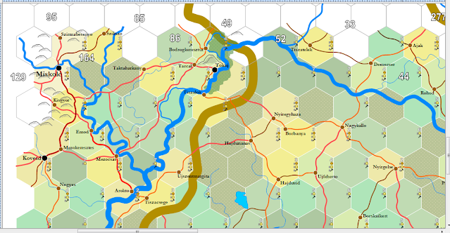
Doesn't look especially difficult. The rivers have to be connected and there are two bigger settlements. But, things can be deceiving. Google earth had a lot to add. Here's what it looked like when I finished:
Loads of fun. A small swamp, multiple river turns and twists and then a marvelous feature I found near Tokaj. Note there's one lone giant hill depicted. Here it is from google earth with an exaggerated 3:1 vertical:
In fact, the peak is 1300 feet above the river and a mere 2.77 miles wide. Here it is with a normal 1:1 perspective:
Neither the English nor the Magyar wikipedias mention the hill at all ... but take it from me, mapping much of the world, this is unusual. I find that it's called Kopasz Hill. According to the description of other mountains in northern Hungary, it's a very old volcano.


That is a very unusual mountain! Definitely something if interest. Kinda calls back to the lonely mountain from the Hobbit in my mind
ReplyDeleteThough not nearly as tall.
ReplyDelete