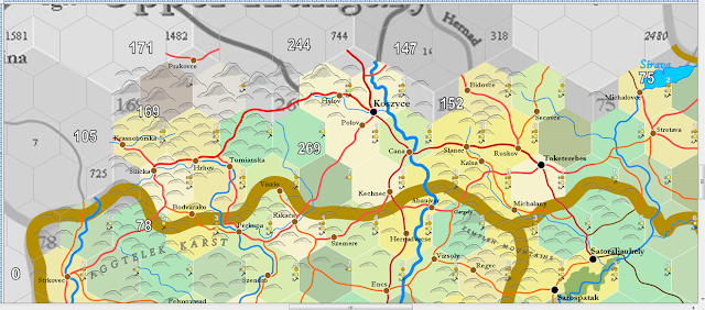
We're in that eastern narrow panhandle of modern Slovakia, wedged between Poland and Hungary. The arm of the country is around 60 miles wide, but it's more heavily populated than most people would realise. Usually, an atlas map gives little detail of the area.
The Aggtalek Karst extends northward into the left hand hex, that with 169 infrastructure ... around the town of Silicka:
The squeeze of fitting roads between the hills and odd river courses is a challenge ... as is the labelling of the map. To make it look good requires changes and experimentations. It's actually easier if you're hand-drawing your map, since the option to twist and turn the word is available. But, I've had a lot of practice, and I'm willing to let the town name cross over a line so long as it's clearly legible.
More mountains to come.


No comments:
Post a Comment
This blog is moderated. Stay on topic.