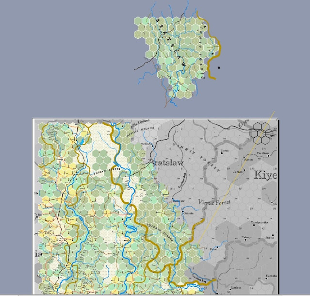
Okay, strange things today. We start with these two figures, before and after:
The emptiness of this part of the world makes the next part easier. The first thing is to grab a large part of the map above and paste it onto the adjoining map to the east, K.30e - Kiyev:
The reader can discern that the new content on top has parts that are duplicated on the sheet map below. These parts have to be cut away from the new content, and the new has to be turned 60 degrees clockwise. In addition, the boundries of the new map have to be adjusted to the new colour and width, and the steppeland hexes on the Kiyev sheet also need an update. Thus:
There. Now the new section needs to be fit into the Kiyev sheet. There are old paths for roads and rivers on the Kiyev sheet that have to be updated to the work we've been doing in the last month, so those ends have to be "sewn" together. Meanwhile, the individual labels must all be turned back (they're at 60 degrees now), including all the symbols for bread, coins and hammers. Finally, the old hexes that are turned must have their colours copied; because of the turn, the old hexes don't quite fit, so they have to be tossed out. But I'll shrink them inside the space of the new hexes, so the information can be easily copied. Here, I'll demonstrate:
Looks like a helluva mess, doesn't it? Here it is again, without the background:
All there is to do is tidy up all the pieces, sew the roads and get rid of the flotsam. Unfortunately, I can't do that just now, as I haven't the time. I'll have a completed version tomorrow, and we'll start the next section.
Oh, I've just realised I forgot to mention the 30th meridian. It's that faint orange line that can be seen on the background maps. I was going to brighten it up, but ... forgot. Can't do it now. 'Til later!


No comments:
Post a Comment
This blog is moderated. Stay on topic.